- Study in AustraliaAustralian Universities/CollegesPrograms by faculty AusAustralian VisasLife in Australia
- Study In New ZealandNew Zealand UniversitiesPrograms by Faculty NZNew Zealand VisasLife in New Zealand
- Study in CanadaUniversities/Colleges in CANADAPrograms by faculty CanadaCanadian VisasLife in Canada
Geography
New Zealand Geography and Geology (Land)
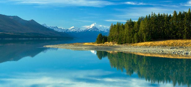
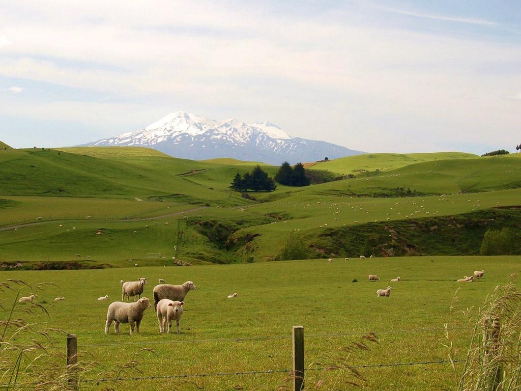
You'll find a variety of awesome landscapes in New Zealand, all within easy reach of each other. Spectacular glaciers, picturesque fiords, rugged mountains, vast plains, rolling hillsides, subtropical forest, volcanic plateau, miles of coastline with gorgeous sandy beaches--it's all here.
Lying in the south-west Pacific, New Zealand consists of two main islands--the North Island and the South Island. In addition, Stewart Island and many smaller islands lie offshore. The North Island has a 'spine' of mountain ranges running through the middle, with gentle rolling farmland on both sides. The central North Island is dominated by the Volcanic Plateau, an active volcanic and thermal area.
The massive Southern Alps form the backbone of the South Island. To the east of the Southern Alps is the rolling farmland of Otago and Southland, and the vast, flat Canterbury Plains. A great driving map resource to help you plan your New Zealand holiday. The map is double sided with the North and South Islands on alternate sides. Dimensions are: 420mm x 610mm. Includes Town Centre Maps of: Auckland, Christchurch, Dunedin, Hamilton, Invercargill, Nelson, Picton, Queenstown, Rotorua and Wellington. Also contains a Travelling Distances chart, and a Travelling Times chart.

Leaving Home
How it Began - New Zealand's oldest rocks are over 500 million years old, and were once part of Gondwanaland. This massive supercontinent started to split up about 160 million years ago, and New Zealand separated from it about 85 million years ago.
New Zealand sits on two tectonic plates--the Pacific and the Australian. Fifteen of these gigantic moving chunks of crust make up the Earth's surface. The North Island and some parts of the South Island sit on the Australian Plate, while the rest of the South Island sits on the Pacific. Because these plates are constantly shifting and grinding into each other, New Zealand gets a lot of geological action.
Earth Dramas
Being straddled over two tectonic plates and sitting on the Pacific 'ring of fire' can have its disadvantages in the form of volcanoes, earthquakes and other natural hazards. However, this subterranean activity also blesses New Zealand with some spectacular geothermal areas and relaxing hot springs, as well as providing electricity and heating in some areas.
Rotorua is the centre of geothermal tourist activity, with plenty of mud pools, geysers, and hot springs in its active thermal areas--not to mention its trademark 'Sulphur City' smell. First settled by Maori who used the hot springs for cooking and bathing, Rotorua soon attracted European residents. The reputed health benefits of its hot pools quickly earned the area the name of 'Cureland'. In addition to Rotorua, you can enjoy hot springs and other thermal activity in most regions of the North Island north of Turangi, as well as in Hanmer Springs and the West Coast in the South Island.
From Long Sandy Beaches to Wild, Rugged Coastlines
New Zealand has over 15,000 kilometres of beautiful and varied coastline. In the far north and on most of the east coast of the North Island you'll find long sandy beaches perfect for swimming, surfing and sunbathing. The North Island's west coast has dark sandy beaches, with sand heavy in iron.
The north of the South Island has some beautiful sandy beaches, while the coastline around the rest of the South Island tends to be wilder and more rugged.
Mountain Range to Fertile Farmland
About a fifth of the North Island and two-thirds of the South Island are mountains. The existence of a 'spine' of mountain ranges throughout New Zealand is also due to the movement of the earth's tectonic plates. Stretching from the north of the North Island to the bottom of the South, these mountains are caused by the collision of the Australian and Pacific Plates.
Over millions of years, alluvial deposits (eroded from the mountains by rivers) formed the vast Canterbury Plains in the South Island and a number of smaller plains in the North. These alluvial plains contain some of New Zealand's most fertile and productive farmland.
Glaciers of Grinding Ice
New Zealand's Southern Alps have a number of glaciers, the largest being Tasman glacier, which you can view by taking a short walk from Mount Cook village. New Zealand's most famous glaciers are the Franz Josef and Fox on the South Island's west coast. Gouged out by moving ice over thousands of years, these spectacular glaciers are easily accessible to mountaineers and hikers. You can walk up to the glaciers or do a heli-hike--fly up by helicopter and walk down.
Sunken Mountains
Mitre Peak overlooks one of the most beautiful parts of New Zealand--Milford Sound in Fiordland. Over thousands of years, the process of subduction has seen parts of the New Zealand landscape become submerged. The Marlborough Sounds and Fiordland are examples of high mountain ranges that have 'sunk' into the sea, creating spectacular sounds and fiords. These areas provide some of New Zealand most picturesque scenery, with steep lush hills plunging down to the deep still bays below. Clear, deep still water surrounded by beautiful bush makes these areas ideal for boating and kayaking.
For more information, please contact one of our offices
Study in Australia | Study in the UK | Study in Malaysia | Study in Canada | Study in the USA | Study in New Zealand


