• Geography

  •  

    Geography of England

    England is made up of about 65% of the island of Great Britain as well as the Isle of Wight and the Isles of Scilly. Scotland borders England to the north and Wales to the west. The Irish Sea, Atlantic Ocean and North Sea surround England, granting it an extensive coastline. This contributes to its natural abundance, popularity amongst locals and tourists and transport system.England covers approximately 130 410 square kilometres or 50 356 square miles and has a population of just under 60 million people.


    England can be divided into:

    1. The Highland Zone
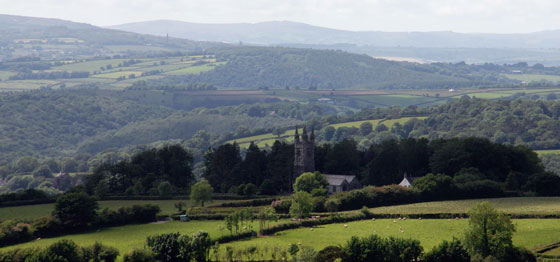
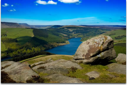
    This zone is characterised by rocky, rugged hills and eroded mountain faces, interrupted by valleys and extensive plains. Because these higher lying areas get less sunlight during the day and more rainfall than the lower lying areas, they are generally colder and unsuitable for farming. The Pennine Mountain Range, Cumbrian Mountains and the mountains of the Lake District are included in the Highland Zone. Some of these mountains peak at an impressive 3000 feet (or 914 metres) above sea level. Devon and Cornwall are situated on a peninsula that is part of the Highland Zone, and is particularly rugged and bare.

    2. The Lowland Zone
    This zone experiences less rain and more sunshine than the high-lying regions. The soil is more fertile, yielding far better crops. The landscape boasts rolling hills that are not very high, making for the ideal place to live and farm. For this reason, most English inhabitants can be found in the Lowland Zone. The Lowlands include the Cotswold Hills, Chiltern Hills, North Downs and South Downs.


    England makes extensive use of its inland waterways, such as its rivers. The Thames River, Mersey River and Tyne River are particularly important as they have formal ports in London, Liverpool and Newcastle respectively. When the tide is high, ships can travel along these rivers and into the ports. The Thames River is also the country’s longest at 346 kilometres in length.

    The Pennines Mountain Range is the oldest of its kind in England, being dated at 300 million years of age. This mountain range measures approximately 400 kilometres or 250 miles in length. The whole area of the Pennines is diverse, boasting valleys, rivers and stark cliff faces as part of its topography. The highest peak in all of England is Scafell Pike (Cumbria), at an amazing 3209 feet or 978 metres above sea level.


    England’s climate is described as being “temperate maritime”. Winter temperatures seldom plummet below zero degrees Celsius, while summer highs can reach about 30 degrees Celsius. January and February are coldest and usually experience snowfall, while July is the hottest month. England is a relatively wet country due to its proximity to the Atlantic Ocean. This, in turn, has created a lush land of greenery and blooms.

    Of the total land area of England, urban development makes up about 21%, crops and fallow land about 30%, grasses and grazing area 36%, other agricultural land 5% and forests about 8%.


    For more information, please contact  one of our offices

    Study in Australia | Study in the UK | Study in Malaysia | Study in Canada | Study in the USA | Study in New Zealand
    Last Updated: 13 January 2013
    Editor:
                                                 Print Friendly Version of this pagePrint Get a PDF version of this webpagePDF
  • Share This Page
    • facebook share google plus share linkedin share telegram share twitter share